
Global
Predictive habitat models are increasingly being used by conservationists, researchers and governmental bodies to identify vulnerable ecosystems and species’ distributions in areas that have not been sampled. However, in the deep sea, several limitations have restricted the widespread utilisation of this approach. These range from issues with the accuracy of species presences, the lack of reliable absence data and the limited spatial resolution of environmental factors known or thought to control deep-sea species’ distributions.

Reefs at Risk Revisited brings together data on the world’s coral reefs in a global analysis designed to quantify threats and to map where reefs are at greatest risk of degradation or loss. We incorporated more than 50 data sources into the analysis—including data on bathymetry (ocean depth), land cover, population distribution and growth rate, observations of coral bleaching, and location of human infrastructure.
This dataset shows the global distribution of mangrove forests, derived from earth observation satellite imagery. The dataset was created using Global Land Survey (GLS) data and the Landsat archive. Approximately 1,000 Landsat scenes were interpreted using hybrid supervised and unsupervised digital image classification techniques. See Giri et al.
Recent revisions to the satellite-derived vertical gravity gradient (VGG) data reveal more detail of the ocean bottom and have allowed us to develop a non-linear inversion method to detect seamounts in VGG data. We approximate VGG anomalies over seamounts as sums of individual, partially overlapping, elliptical polynomial functions, which allows us to form a non-linear inverse problem by fitting the polynomial model to the observations.

Clean water and the many products and services of aquatic ecosystems are necessities for human welfare. Water connects human societies and ecological systems by providing food and energy. The hydrological cycle maintains the health and stimulates the productivity and diversity of all ecosystems.
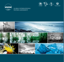
The International Global Waters Assessment will be based on assessments of 66 international waters, of the ecological status of these water areas and the causes of environmental problems of the regions — international waters comprising marine, coastal and freshwater areas, and surface waters as well as groundwaters — in nine major regions. Focus will be on the key issues and problems facing the aquatic environment in these international waters.
This dataset shows the known locations of sea turtle feeding sites, for five of the seven species: hawksbill turtle (Eretmochelys imbricata), leatherback turtle (Dermochelys coriacea), green turtle (Chelonia mydas), loggerhead turtle (Caretta caretta), and olive ridley turtle (Lepidochelys olivacea).
This dataset shows the known locations of sea turtle feeding sites, for five of the seven species: hawksbill turtle (Eretmochelys imbricata), leatherback turtle (Dermochelys coriacea), green turtle (Chelonia mydas), loggerhead turtle (Caretta caretta), and olive ridley turtle (Lepidochelys olivacea).
This dataset shows the known locations of sea turtle nesting sites, for all seven species: hawksbill turtle (Eretmochelys imbricata), Kemp’s ridley turtle (Lepidochelys kempii), leatherback turtle (Dermochelys coriacea), green turtle (Chelonia mydas), loggerhead turtle (Caretta caretta), olive ridley turtle (Lepidochelys olivacea), and flatback turtle (Natator depressus).
This dataset is no longer being maintained and must be used with caution.