Discover Data
This dataset contains the global distributions of habitat suitability for seven suborders of cold-water octocorals (Octocorallia) found deeper than 50 m: Alcyoniina, Calcaxonia, Holaxonia, Scleraxonia, Sessiliflorae, Stolonifera, and Subselliflorae.

This dataset shows the known locations of sea turtle feeding sites, for five of the seven species: hawksbill turtle (Eretmochelys imbricata), leatherback turtle (Dermochelys coriacea), green turtle (Chelonia mydas), loggerhead turtle (Caretta caretta), and olive ridley turtle (Lepidochelys olivacea).
The International Global Waters Assessment will be based on assessments of 66 international waters, of the ecological status of these water areas and the causes of environmental problems of the regions — international waters comprising marine, coastal and freshwater areas, and surface waters as well as groundwaters — in nine major regions. Focus will be on the key issues and problems facing the aquatic environment in these international waters.
This dataset shows the global distribution of coral reefs in tropical and subtropical regions. It is the most comprehensive global dataset of warm-water coral reefs to date, acting as a foundation baseline map for future, more detailed, work.
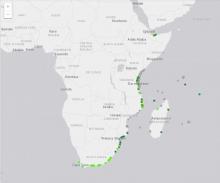
WIO under sea cables layer has been derived from Greg's global cable map which attempts to consolidate all the available information about the undersea communications infrastructure. The initial data was harvested from Wikipedia, and further information was gathered by simply googling and transcribing as much data as possible into a useful format, namely a rich geocoded format.
This vector layer shows the location marine areas managed at a local level by the coastal communities through collaborative groups, organisations and government representatives who reside or are based within the immediate area.