
Biophysical environment
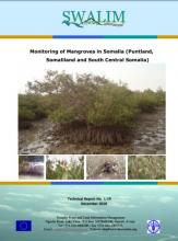
Monitoring is the repeated observation of a system in order to detect signs of change. Monitoring can be used to quantify change, identify the causes of change and determine acceptable levels of change. Socioeconomic monitoring allows us to understand what kind of human induced factors affect the mangrove, whether people are benefiting from the current levels of management and how they perceive the ecosystem in question. Ecological monitoring allows us to form a picture of how the ecosystem is doing.
The Secretariat prepared and submitted to Sida an application for US$6,000,000 for a four year Africa marine and coastal programme to be implemented in the Sub-Saharan Africa including Small Island Developing States in the eastern Atlantic and western Indian oceans.

The Conference of Plenipotentiaries was convened by the Executive Director of the United Nations Environment Programme (UNEP) in pursuance of decision CP5/4 adopted at the fifth Conference of Parties ICOP5) to the Nairobi Convention For the Protection, Management and Development of the Marine and Coastal Environment of the Eastern African Region held in November 2007, in Johannesburg, South Africa.
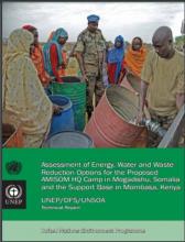
UNEP undertook a preliminary assessment of the resource-demand and operating practices of two proposed African Union Mission to Somalia (AMISOM) camps, in Mogadishu (HQ Camp), Somalia and Mombasa, Kenya (Support Base) in June 2009.The assessment compared the existing design parameters and operational specifications for each site and screened 132 potential resource efficiency measures that could be applied to achieve a reduction in energy and water consumption as well as was
Adopted in Nairobi, Kenya on 31 March, 2010
Preamble

Working document of the 14th Global Meeting of the Regional Seas Conventions and Action Plans
This Transboundary Diagnostic Analysis (TDA) has been developed jointly by the ASCLME and SWIOF Projects in 2012 and is the regional synthesis report on the current status of the Agulhas and Somali Current Large Marine Ecosystems. It presents an analysis of the ecosystem status and the threats to the long term sustainability of coastal and marine processes and resources in the region.
During the focal points meeting of the Nairobi Convention held in August 2012, in Maputo, Mozambique, the contracting parties adopted an outline to be used in the preparation of the World Oceans Assessment report. The meeting also agreed that the adopted outline will also serve as the outline for the Regional State of the Coast report for the Nairobi Convention.
This Transboundary Diagnostic Analysis (TDA) has been developed jointly by the ASCLME and SWIOF Projects in 2012 and is the regional synthesis report on the current status of the Agulhas and Somali Current Large Marine Ecosystems. It presents an analysis of the ecosystem status and the threats to the long term sustainability of coastal and marine processes and resources in the region.
The Ocean Health Index is a new method to define and quantify the health of the ocean in a comprehensive and integrated way. A healthy ocean is defined as one that can sustainability deliver a range of benefits to people now and in the future. The Ocean Health Index (the Index) tracks how countries are doing across a portfolio of 10 goals that people have for a healthy ocean.
