Physical Alteration and Destruction of Habitats
The Republic of Mauritius consists of a main island, Mauritius (20º17’ S, 57º33 E), and a group of small islands in the South West Indian Ocean namely Rodrigues, the Cargados Carajos, Agalega, Tromelin and the Chagos Archipelago. The total land area amounts to 2040 km2 whilst the marine exclusive economic zone covers an area of about 1.9 M km2 extending from 100 S to 200 S and from longitude 550 E to 750 E.
Major tourism impact in the physical alteration and destruction of habitats is mostly due to the tourism operation, rather than building of tourism infrastructures. The major degrading tourism activities are building in sand dunes and in mangrove swamps, and driving in coastal dunes. The major areas affected by tourism are the southern part of Mozambique, in the parabolic dune environment. Mangrove destruction is mostly due to urban expansion.
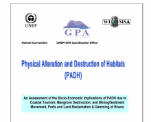
The United Nations Environment Programme as the Secretariat of the Global Programme of Action for the Protection of the Marine Environment from Land-based Activities (GPA) established the GPA Coordination Office in The Hague, The Netherlands after the adoption of the GPA in Washington D.C. in 1995.

This report presents an assessment of the social and economic importance of three priority activities contributing to physical alteration and destruction of habitats (PADH) within the coastal and marine environments on the well-being of countries in the Western Indian Ocean (WIO) region. These activities include:
Madagascar est la 4ème plus grande île du monde, plus précisément. En effet, outre sa superficie qui couvre 590.750 km², elle se prolonge dans l’océan par un plateau continental pouvant aller jusqu’à p^lus de 100 km couvrant ainsi une superficie supplémentaire de 117.000 km². Madagascar est une république dotée de 6 provinces, 28 régions et de près de 1300 communes.
In this report a review of national policies and legislation addressing issues of the alteration and destruction of critical coastal and marine habitats, and the institutional arrangements towards alleviating the same is presented. The land-based social and economic activities impacting on the habitats and the extent to which the latter are affected is assessed. Emphasis has been placed on the link between the impacts and tourism or tourism catalysed activities.